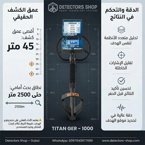


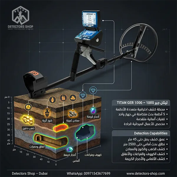
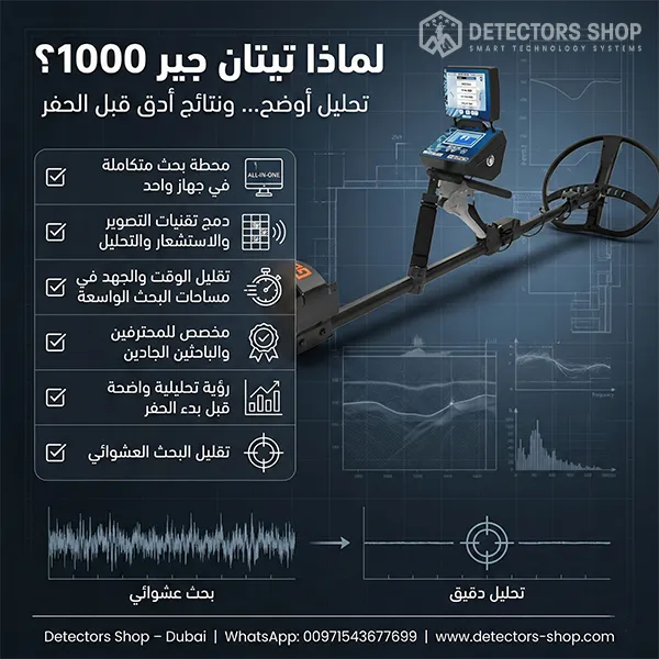
1.
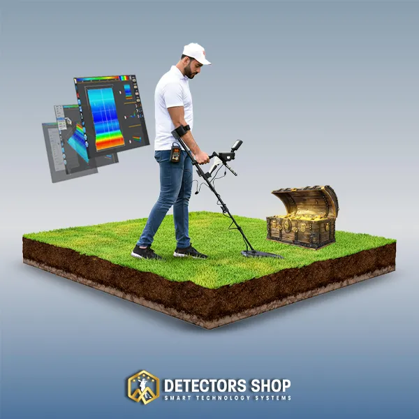
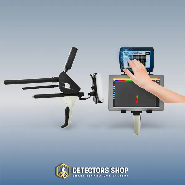
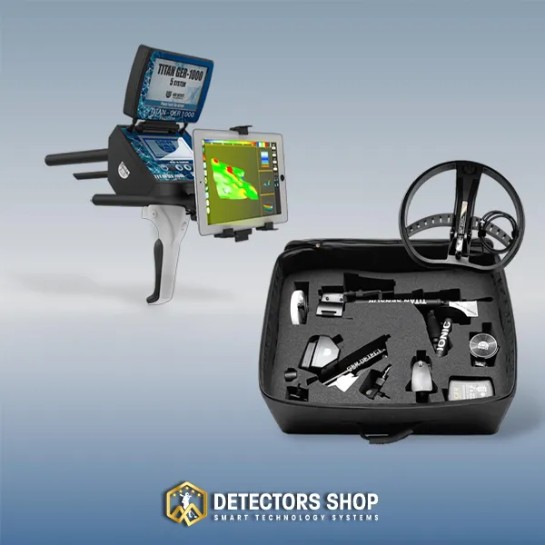
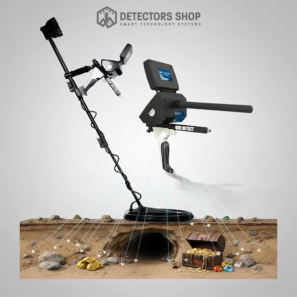
نظام التصوير ثلاثي الأبعاد
يقوم هذا النظام بتصوير طبقات الأرض بالكامل، وعرض نتائج التصوير من جميع الاتجاهات على شاشة الجهاز، مما يتيح رؤية الشكل التقريبي للهدف المكتشف سواء كان معدنًا، كنزًا، فراغًا، كهفًا، أو ممرًا تحت الأرض.
كما يحدد النظام عمق الهدف بالمتر والسنتيمتر بدقة.