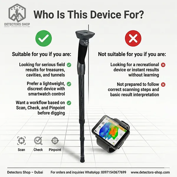


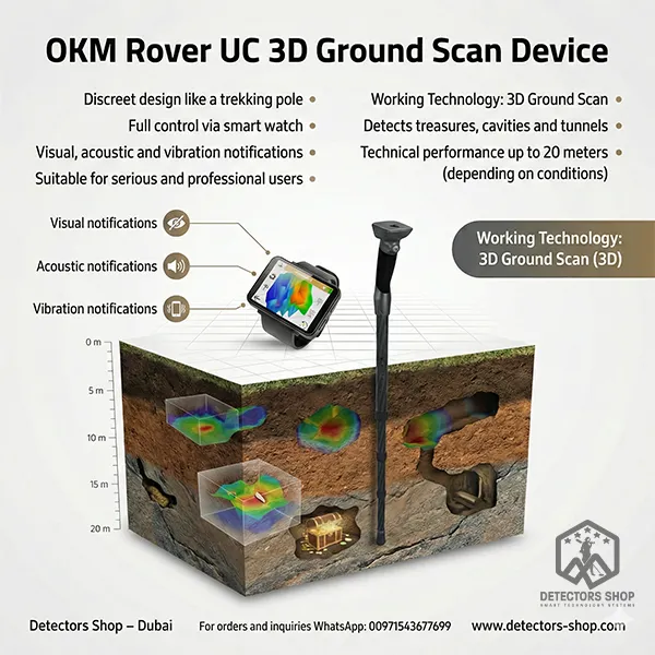
1.
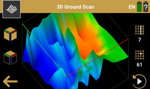
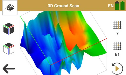
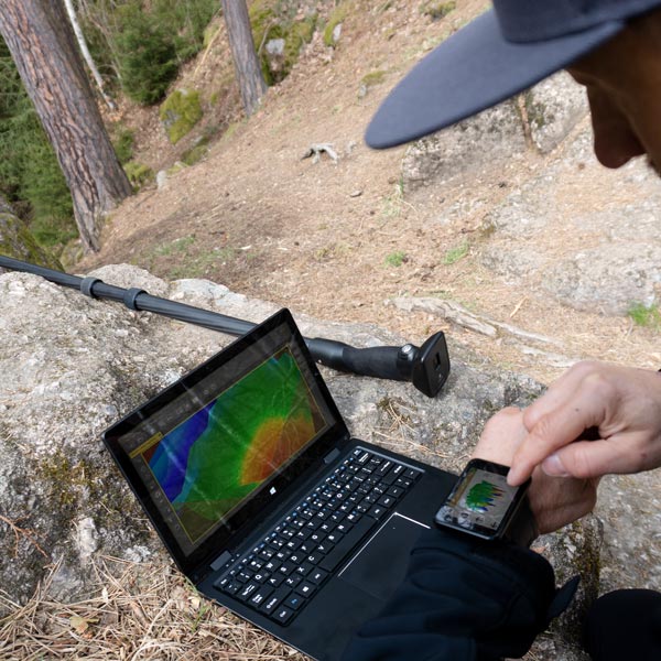
3D Ground Scan
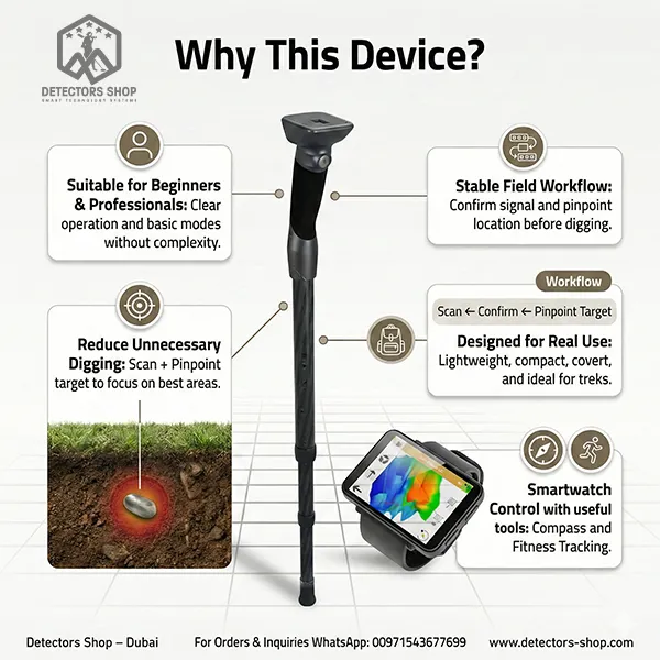
This mode is used to scan the ground in organized lines to identify subsurface anomalies related to buried targets. Scan results can be reviewed and examined (zoom/rotation) for better interpretation. Its field advantage is helping users make a more informed digging decision based on scan visualization rather than relying on a single momentary signal.