


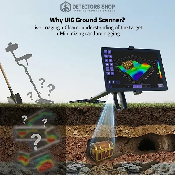
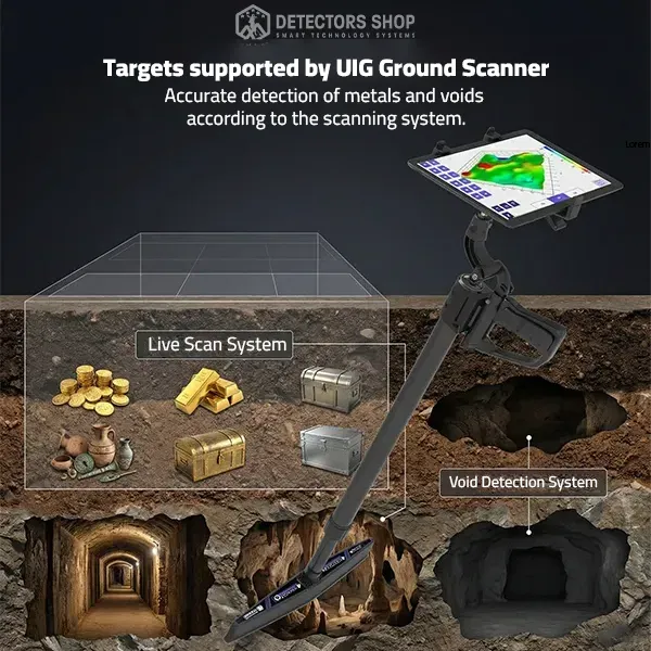
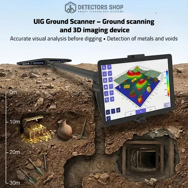
1.
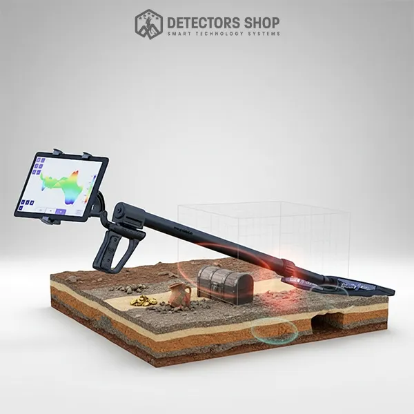
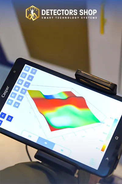
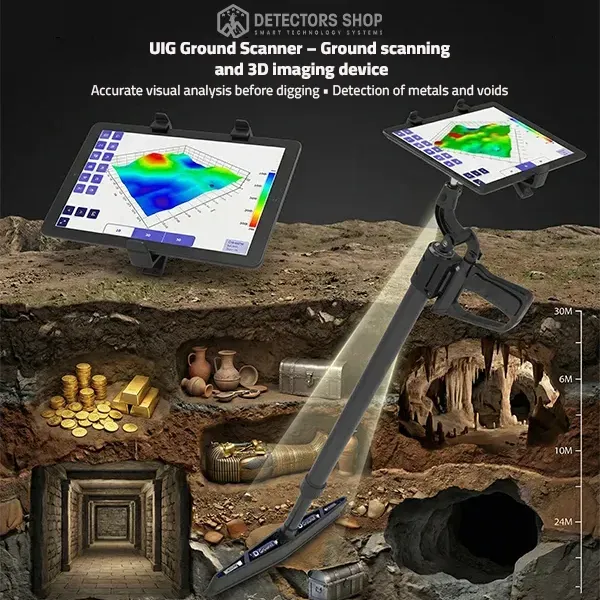
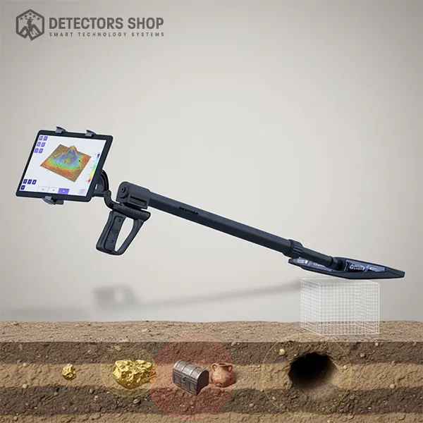
3D Imaging System
This system scans all soil layers and displays imaging results from multiple angles on the device screen.
It helps to:
Clarify the shape of the detected target
Distinguish whether the target is metal or a void
Determine target depth in meters and centimeters
Detect treasures, metals, caves, voids, tunnels, and graves
This system is essential for analyzing the target before making an excavation decision.